In 1894 British publishers were given permission to manufacture and distribute picture postcards but it wasn’t until 1902 that the Post Office approved the use of postcards with a divided back so that the address and message could be on one side and a full size illustration on the other (thus saving putting the postcard in an addressed envelope). This began a boom in postcard manufacturing and writing with companies like F Frith & Co. at the forefront.
Not all postcards had a manufacturer’s name on them and some had a manufacturer’s name but added that it was published by someone local – R.Evans Armitage for example. If you have examples of Armitage related postcards other than those shown here I would love to hear from you.
These postcards are arranged to follow a route through the Parish.
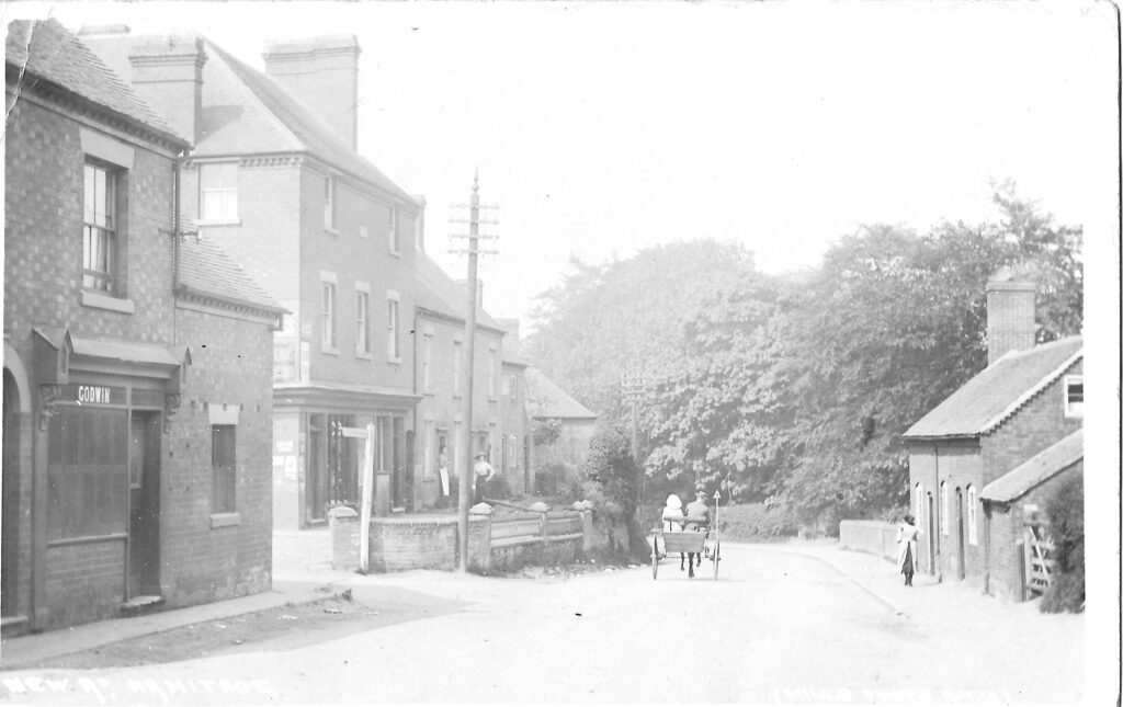
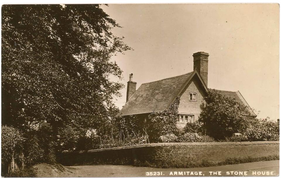
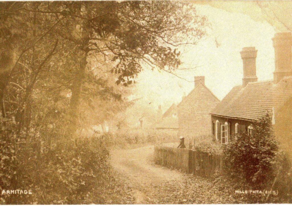
The view here is the junction of Old and New Roads and the toll gate would have stretched, from the Toll Gate house on the left, across both roads. The cottages on the right are no longer there but the stone wall just past them is – it belongs to the Stone House which is in the postcard below. This house used to be the Post Office until the late 1890s and was on the corner of Rugeley Road and Boat House Lane.
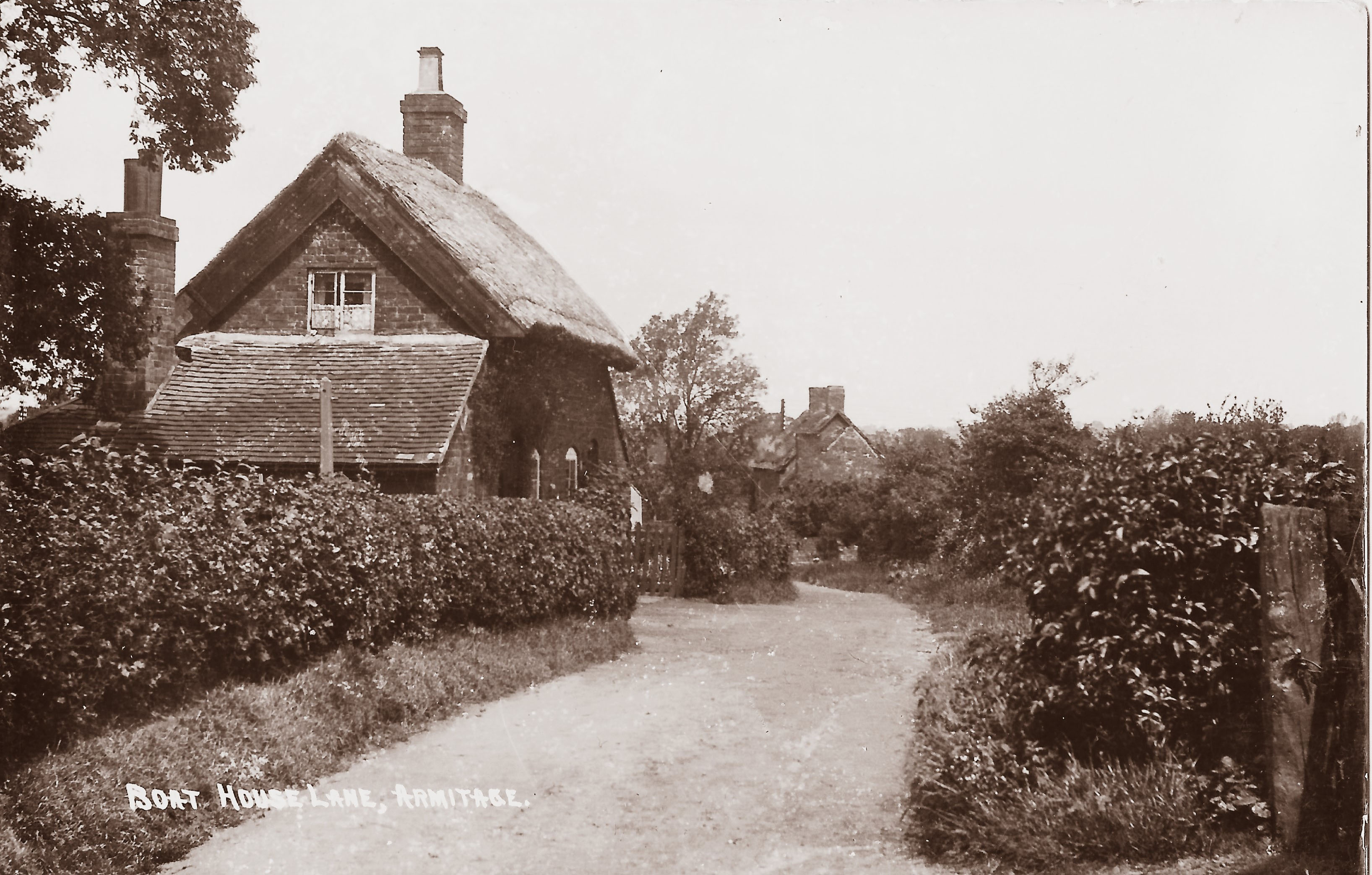
The next two postcards show different views in Boat House Lane – named for the Boat House pub next to the canal at the end of the lane.
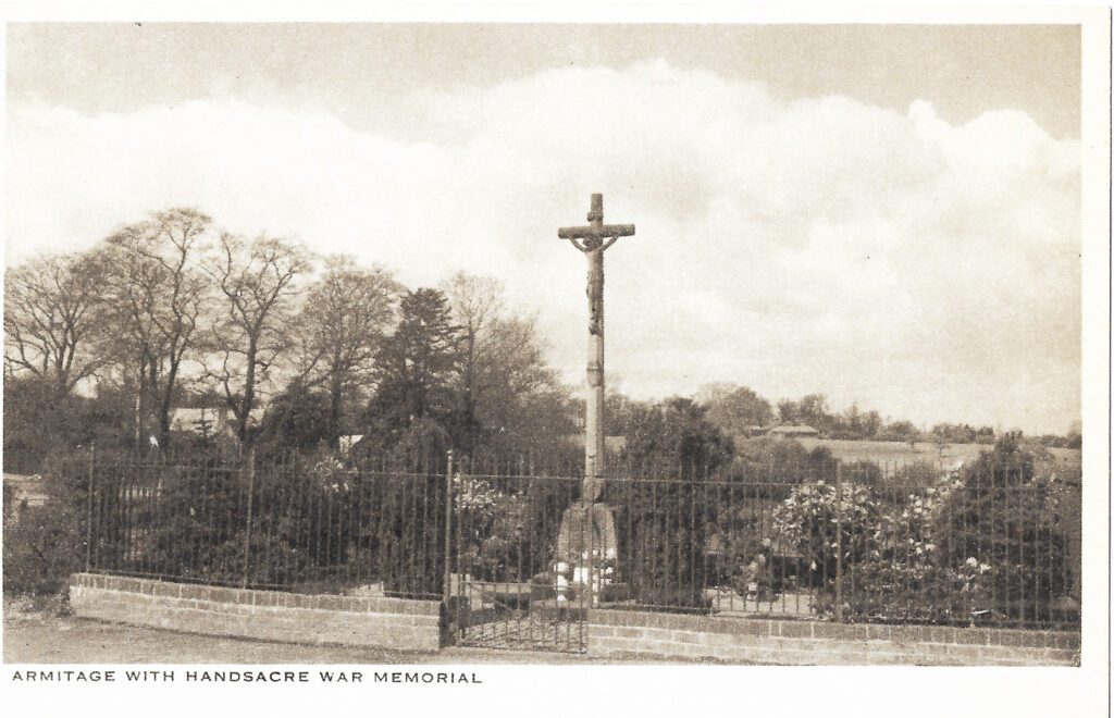
The War Memorial in its original location on the other corner of Boat House Lane. The postcard is unposted and was produced by the Rapid Art Company of London and the back also states ‘Published by R. Evans, The Newsagent, Armitage with Handsacre, Staffs. 12206’. The Morecroft family donated the land and the memorial was dedicated on Sunday 15th February 1920. In 1968 the memorial was moved to its current location at the end of Millmoor Avenue.
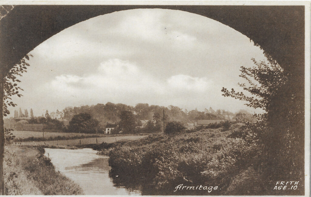
Taken from underneath Linfield bridge – the track over the top goes from the Church House farm (off to the right of the picture) to the fields split by the railway lines known as Big and Little Linfields this postcard is by F Frith & Co.. (The name Linfield probably indicates that the field was used to grow flax (linseed) which would have been used for making cloth). Roughly in the centre of the picture is a white building – Armitage Cottage – with the bottom houses of Chapel Road to the right. The picture was taken in the 1950s.
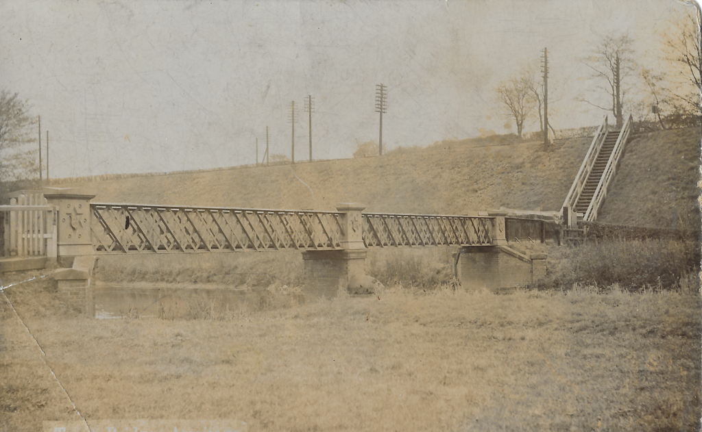
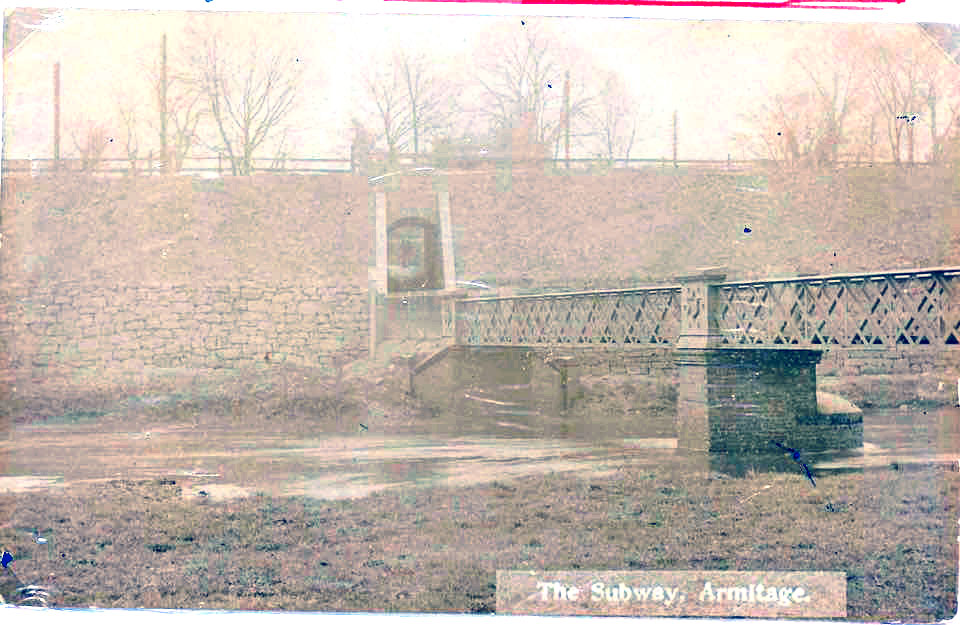
Two views of the bridge over the river to Mavesyn Ridware with (on the left) a foot crossing over the railway followed by steep steps and (on the right) the current subway under the railway. In 1902 the two Parish Councils (Armitage and Mavesyn Ridware) wanted a footbridge to replace the pedestrian level crossing but eventually accepted the provision of a subway. Nothing was done however until 1912 when the number of railway lines was doubled. The two councils then asked for white tiles and lighting in the subway because of its remote location. LNWR offered to supply lights if the Councils were prepared to keep them supplied and lit – a long time before the villages had mains electrical power – and would install white tiles if the Councils paid £173 for them. And there the matter rested.
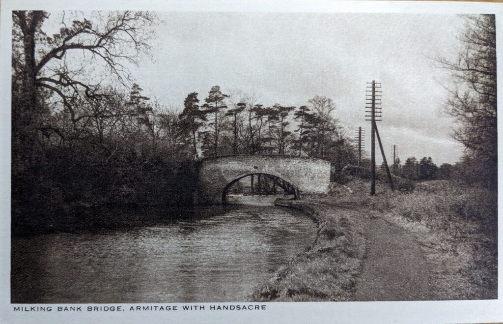
Following along the canal towards Rugeley, past what a 1795 plan of the canal shows as the Armitage Stone Quarry, we come to the milking bank bridge. According to the 1795 plan this was called Chantry Bridge (although chauntry on some documents) but I have always known it as ‘milking bank bridge’. The tithe map (1841) shows that between the bridge and the church the field was ‘The milking bank & piggeries’ and the field between that and Rugeley Road was called Chantry Field. No doubt it had all been one field at one time. (The name ‘chantry’ dates back to the Middle Ages and suggests that the field was donated to the church so that a mass could be sung – the church in the Middle Ages was of course, like all the others in Britain, a Roman Catholic one).
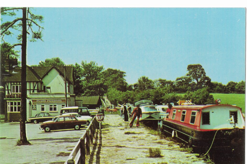
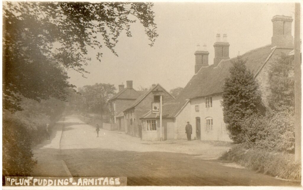
This shows the Plum Pudding, probably at some time in the 1970s. Through the trees is Bridge 61A – it used to be Armitage Tunnel but subsidence caused problems and the tunnel was removed and replaced by a cutting and a road bridge.
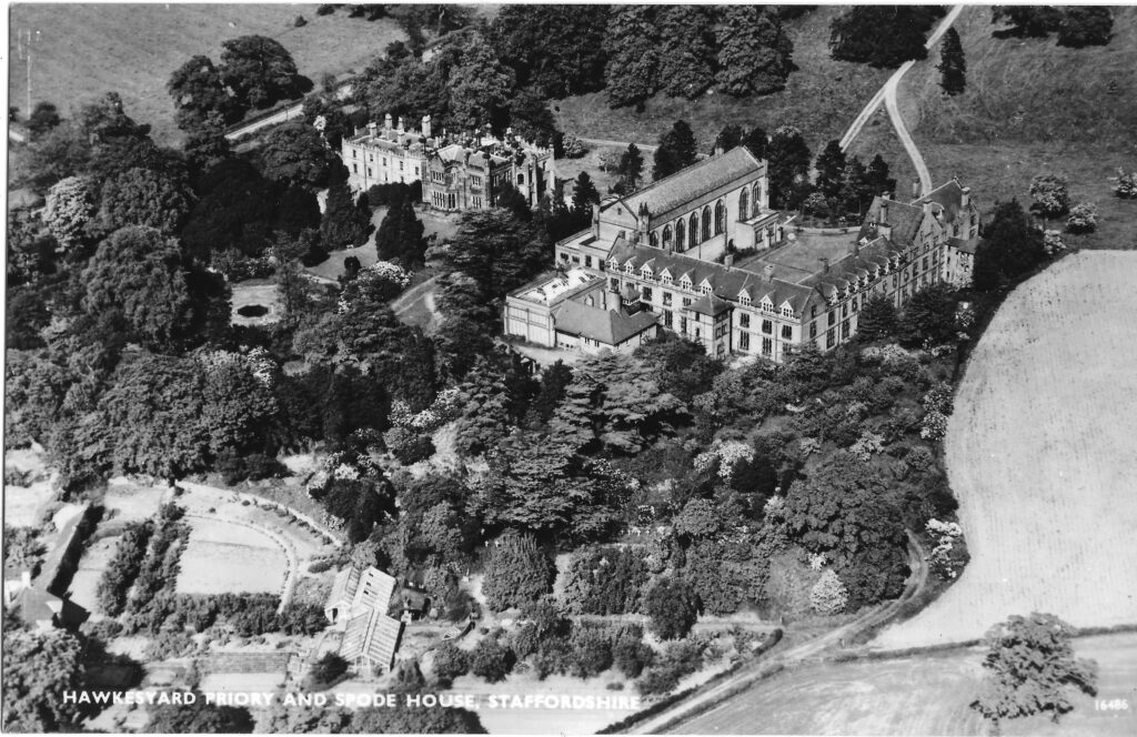
Above is Hawkesyard Priory and Spode House – this is the last postcard at this end of the Parish – time to turn round and head back. This view of the Plum Pudding dates back to c1920.
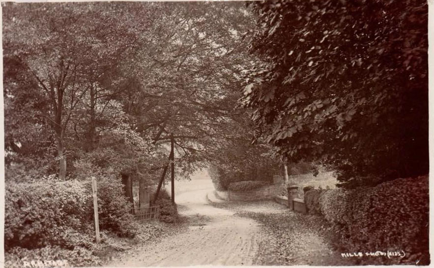
This postcard shows the view from outside the Plum Pudding looking at the Armitage Lodge boundary wall with Lower Lodge farm just in front of that. It was taken in the early years of the 19th C and shows a footpath on the right and a very dusty road – before the invention of tarmacadam.
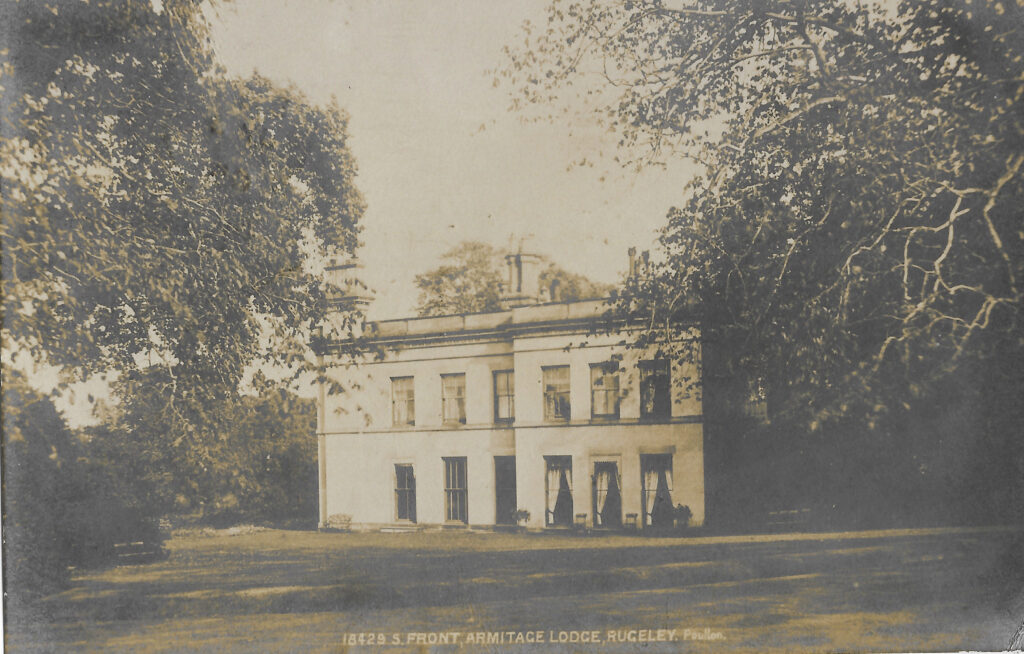
Continuing our route back now towards the centre of Armitage this postcard shows Armitage Lodge. In 1806 the Birch family bought it from George Harvey of Yoxall and it was sold to Rev Edward Sansom of Brereton ninety years later. This postcard was sent by to a Miss Birch of Poole in 1905 by K.E.Pascoe, who was probably part of Pascoe & Sons, stationers of Rugeley, with just a simple comment ‘With our kind regards’.
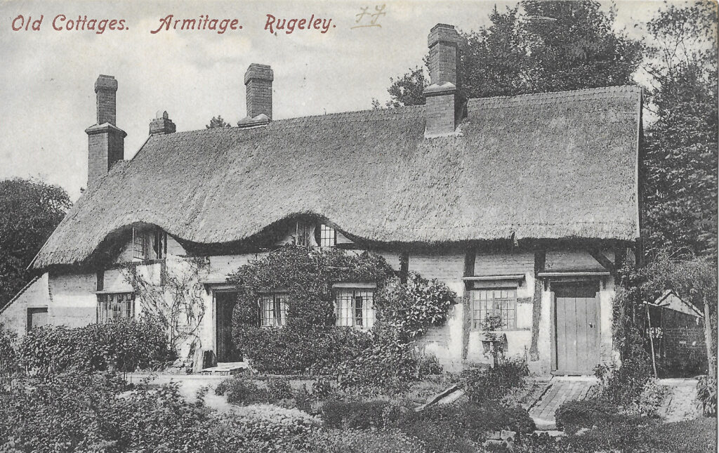
Opposite the old (National) school this was originally two or three cottages but is now only for one family and it features on a lot of postcards. This particular one was sent to Miss D Evans of Bognor, Sussex – ‘for her collection’. The cottage is famous for one of its earlier inhabitants – Antoine Albena Mountsoy who was born in Bordeaux in 1787 and lived in the cottage for the last ten or so years of his life up to his death in 1896 at the ripe old age of 109.
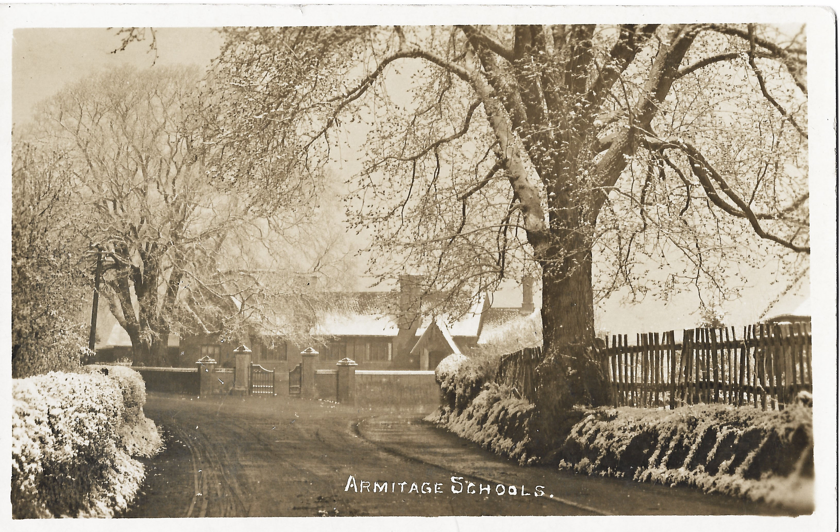
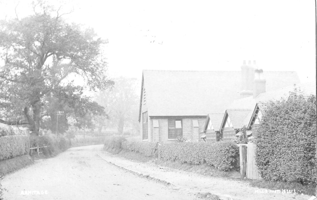
Like the cottage above, the National school at the top of Church Lane features on lots of postcards. This postcard is from the early 1900s. The National School was built in 1839 and carried on as a school for 100 years. In the right hand corner of this picture the house that stood on Stocks Bank can just be seen.
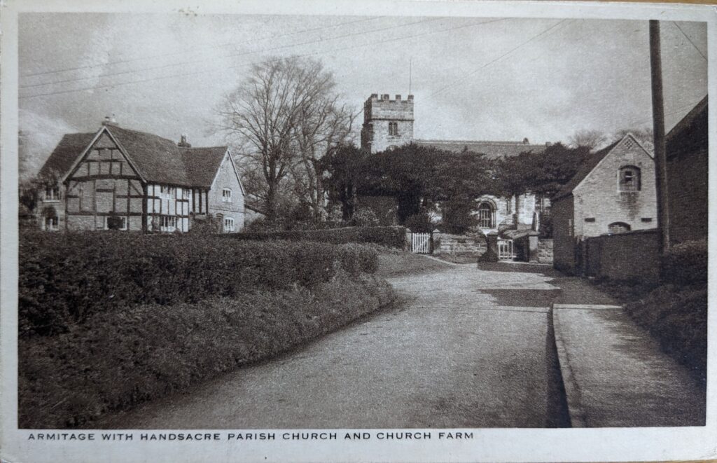
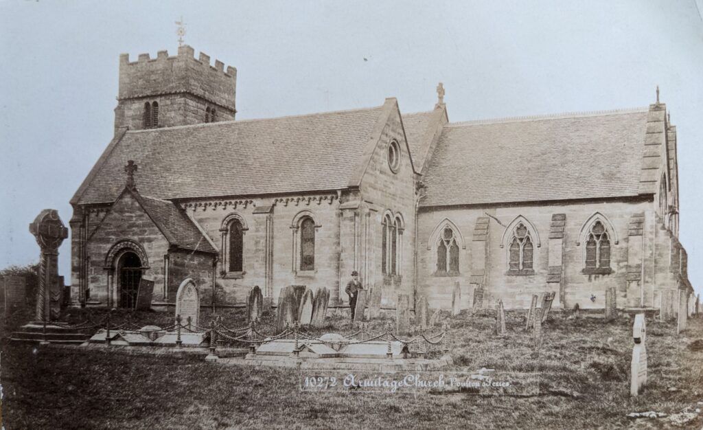
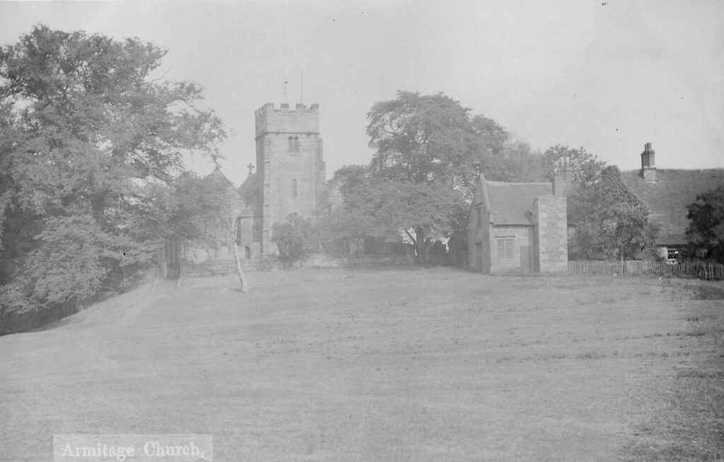
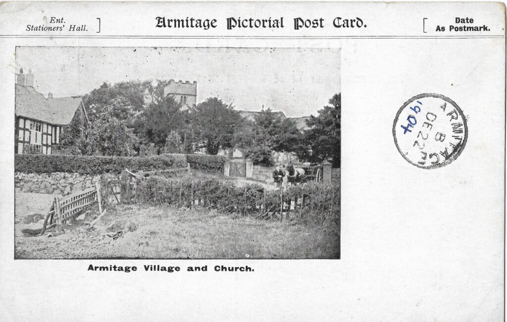
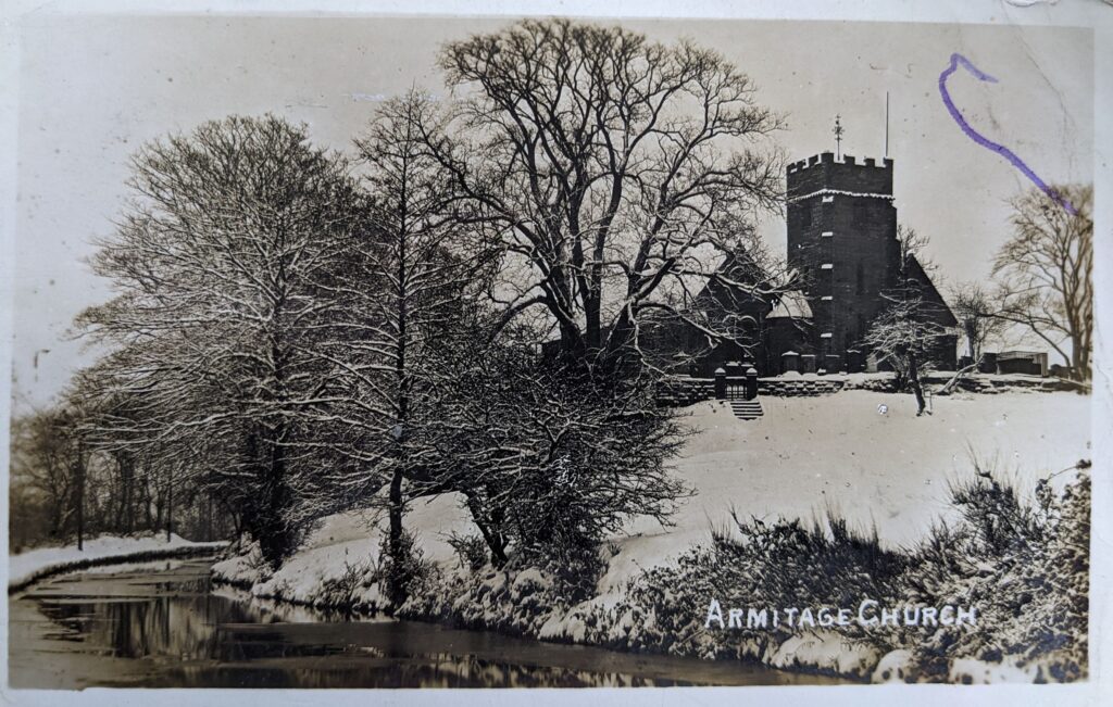
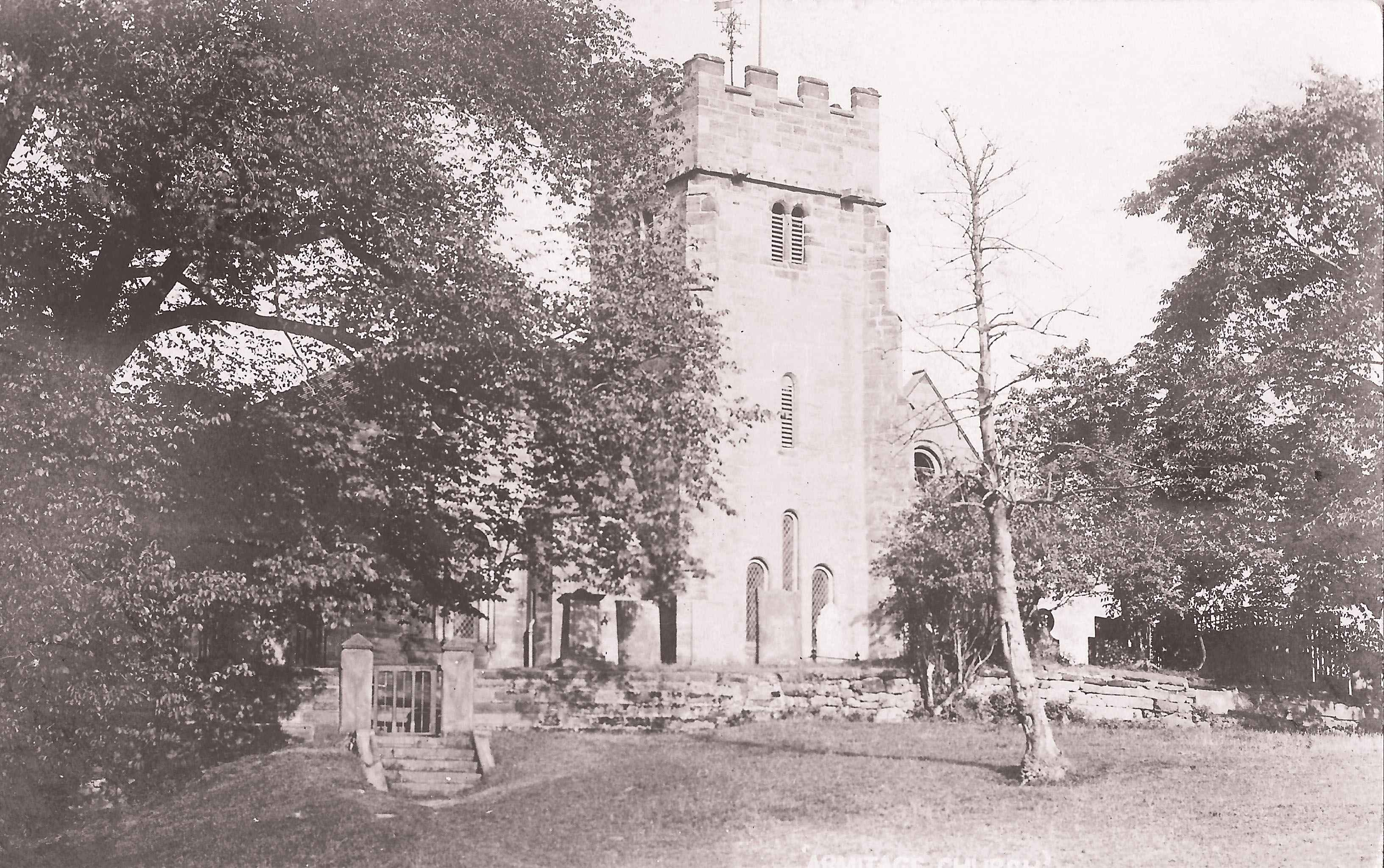
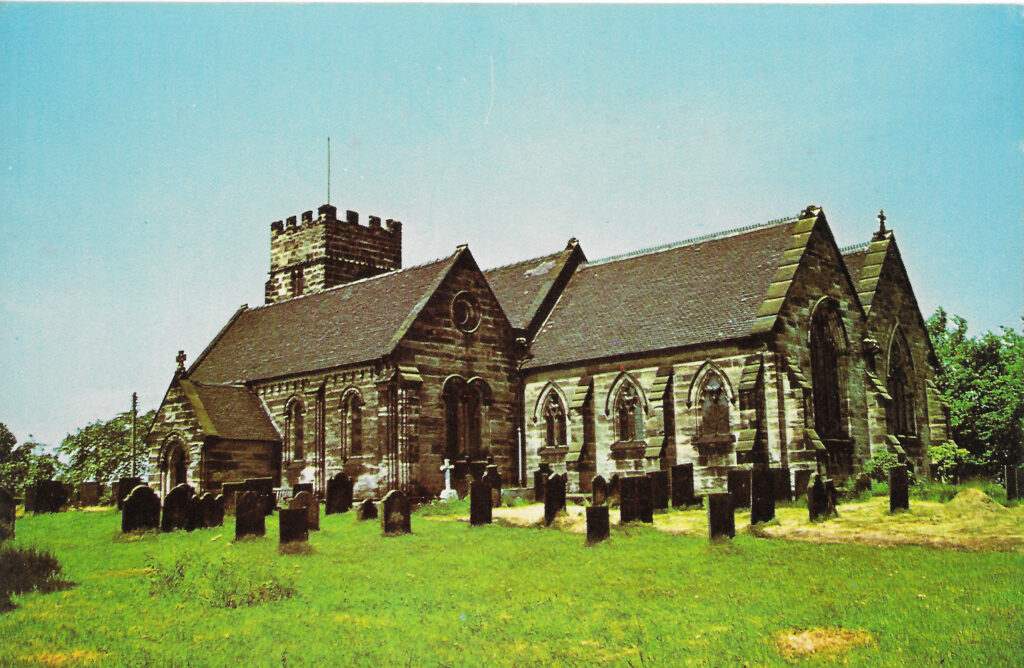
St. John the Baptist church – some of it’s many postcards
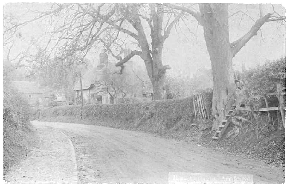
This was a thatched cottage called Rose Cottage that would now be on the corner of Upper Lodge Road. Steep steps like those leading up into the field were often found in the village and would carry pedestrians straight onto the roadway – not a problem when the only traffic was horses, carts and other pedestrians.
This postcard is probably from about 1910 and shows the Parish Church Room and the Almshouses – the room and almshouses were donated by the Rev. Edward Samson to the Lichfield Diocesan Trust in 1908.. The gate opposite is for Ivy Cottage which, along with the rest of the farm, had by then been bought by the pottery. In 1911 one of their Directors, Otto Ahlmann, was staying there – he was a German who became naturalised at the start of World War I. It was on part of the farmland that the pottery built houses for their workers – Ricardia, Volcania and Itonia Terraces (named after some of their closets).
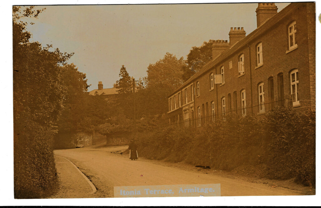
Looking in the opposite direction this postcard shows Itonia Terrace and the junction between Rugeley Road, Rectory Lane and Pike Lane. The Co-op, now Londis, wasn’t built until 1911 so this card would probably be from the 1911 – 1920 period. It shows the line of the original road.
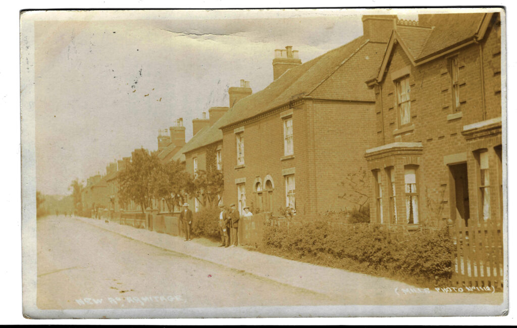
Coming back now to our starting point at the old toll gate we are on the New Road – now nearly 200 years old as it was built in about 1830. The postcard is addressed to Miss A Davis, Bromsgrove and states ‘This is the road I live in. Am making good use of my horse. Sam is going straight to Aldershot’. The date cannot be read but the text suggests World war 1.

Probably taken at a similar time this postcard looks back up New Road towards the toll gate.
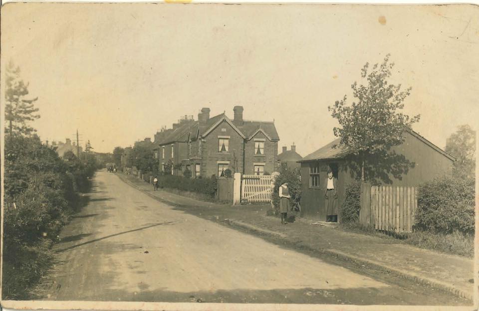
Another postcard of the New Road. Without an identifiable date this shows a hut that was moved from the Brocton camps after World War 1 and was used as a newsagents. Behind the hut is the site of the current post office. The white gate just beyond the hut is the road down to the railway sidings.
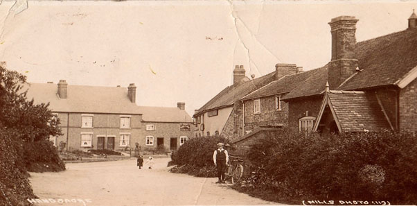
We’re heading in to Handsacre now and there seem to be very few postcards for Handsacre. It may be because at the peak of postcard popularity Handsacre was smaller than Armitage but the absence of postcards for, say, Handsacre Hall is surprising. Driving under the railway bridge into Handsacre the first site is the Handsacre Temple. This postcard states ‘Real Photo’ across the top and looks to have been taken from the entrance to Armitage Station.
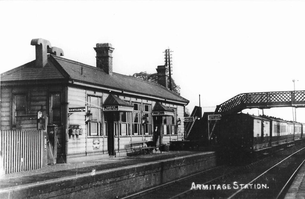
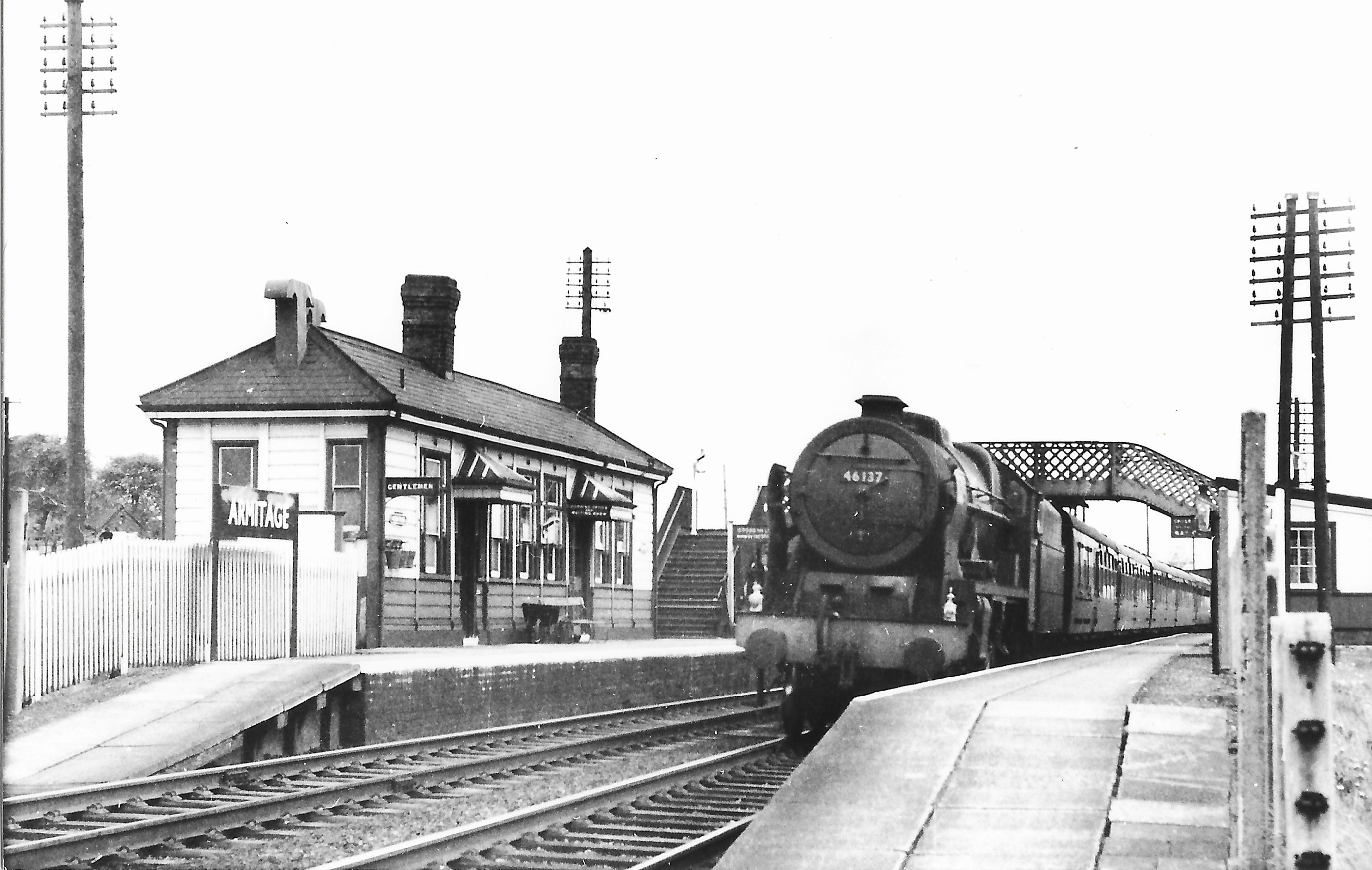
Armitage Station was just under the railway bridge and in Handsacre, not Armitage. It was closed as part of the Beeching cuts in 1960.
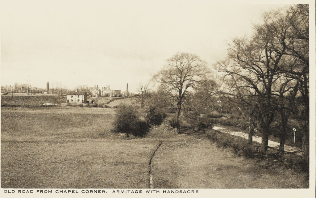
Taken from the Chapel Corner looking back into Armitage this shows Friday Croft (known as Pop’s Ocean) with the Fog Cottages in the middle distance. These cottages were built for the railway workers, often the ones who had to walk the line, and Fog Cottages can be seen in lots of places – next to Rugeley railway station for instance. On the other side of the railway you can see the bottle kilns of the pottery. Old Road (on the right) is pretty winding and just through the trees the road goes through Dummies Brook (as we would call it as children). Notice the road sign – you could go along there as fast as you liked until the late 1960s when a national speed limit came in.
The postcard above shows the view down Hall Road with the Red Lion (now the Old Peculiar) at the end of this road on the right. This would have been the road leading directly to Handsacre Hall which originally had faced out over the River Trent rather than on to Lichfield Road.
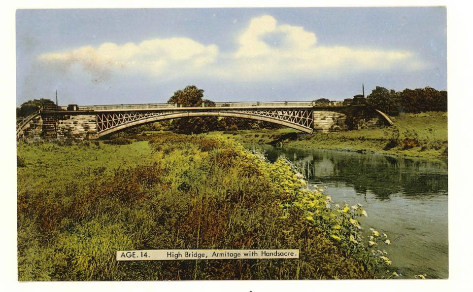
Built between 1829-32 as a replacement for the old multi-arched bridge further downstream this was one of the largest single-arched cast iron bridges in Britain. On the parapet is a cast-iron transcription celebrating the fact, naming the foundry company (Coalbrookdale), the surveyor (Joseph Potter) and the Chairman of Ye Quarter Sessions!
This final postcard doesn’t have an exact location and shows that they would publish all sorts of postcards.