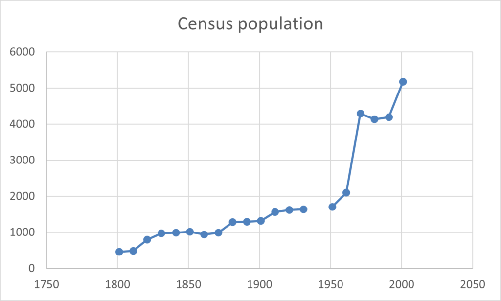
The Parish of Armitage-with-Handsacre is in the Lichfield Superintendent Registrars District and, below that level, in the Rugeley Registrars District and consists of two Enumeration Districts. It’s area up to the 1931 census was just under 1950 acres. After a boundary commission in 1934 the area dropped to 1900 acres and in 1964 the area dropped even further when the parts of Brereton village it held were transferred to Rugeley. For the first four years of the census – 1801,1811,1821 and 1831 – the only records available are total population numbers, a split between male and female and some occupation statistics.
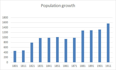
Between 1811 and 1821 the graph above shows quite an increase thanks to the pottery and the brickworks. Later increases are due to the pottery and Brereton collieries.
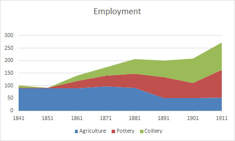
The population grew quite substantially from demand for workers at both the pottery and colliery and this population growth was wholly in Armitage and Brereton respectively. This disguised the decline in employment in agriculture which in addition to using less workers also switched more to the farmers’ family themselves doing a lot of the work.
From 1841 onwards the census included names and over the years additional questions have regularly been added. The government operate a 100 year restriction on individual’s details and the 1921 census details are not due to be released until 2022. This will be the last UK census release for the next 30 years because the 1931 census records were destroyed in a fire during WW2 and there was no census taken in 1941. Population figures are available for later years as shown below.
Clicking on the buttons below will take you to information and transcripts on the individual year.