
Today, boats travelling along the Trent & Mersey Canal through Armitage pass through a deep sandstone cutting beside the A513. There is little to suggest that for almost two centuries this stretch of canal disappeared underground.
This was the site of Armitage Tunnel, one of the earliest tunnels on Britain’s developing canal network and an unusual survivor of James Brindley’s pioneering engineering. Opened with the Trent & Mersey Canal in the 1770s, it remained in use for almost two centuries until mining subsidence finally threatened its survival.
Its story began, however, with an unusual choice of route.
Why was there a tunnel at Armitage?
James Brindley was one of the great engineers of the early canal age. Wherever possible his canals followed the natural contours of the landscape. By maintaining a level course around hills rather than cutting through them, expensive earthworks, locks and tunnels could be avoided.
At Armitage there was an obvious route which would have followed this principle and avoided the sandstone ridge altogether. Yet this was not the route eventually taken.
Instead the canal was diverted across land belonging to Nathaniel Lister of Armitage Park. The new alignment took it directly towards the sandstone ridge, making substantial excavation and a tunnel necessary, as well as an additional bridge near the Ash Tree. Lister met the additional cost.
Cutting through the sandstone
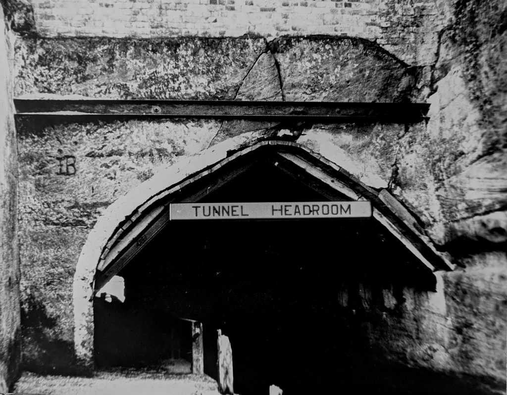
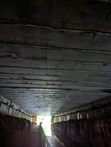
Brindley’s solution was to drive a tunnel through it. The original intention was to carry the tunnel for nearly 200 yards, but unstable rock forced the engineers to shorten it to about 130 yards, opening the remainder out as a cutting. The tunnel itself was cut largely through the natural sandstone and was not fully lined with brickwork, although its shallow curved roof was formed with a brick arch.
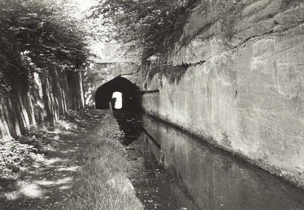
It was unusually wide for an early canal tunnel because a towpath ran alongside the water. This increased the amount of rock that had to be excavated, adding substantially to the cost.
The alternative can be seen in Brindley’s first Harecastle Tunnel, opened in 1777. There, no towpath was provided. The towing horse had to be detached and taken over the hill while the boat was propelled through the tunnel by a laborious process known as ‘legging’. Men lay on their backs or sides on the boat and pushed with their feet against the tunnel walls or roof, slowly forcing the boat through the darkness.
At Armitage the horse could continue pulling the boat through the tunnel, making passage considerably easier.
Travelling through Armitage Tunnel
For generations of boatmen, the tunnel became simply another feature of the journey along the Trent & Mersey.
The surviving photographs give a much better impression of it than the present landscape can. Boats passed through a narrow channel between high sandstone walls before disappearing beneath the low roof. The towpath squeezed alongside the water.
From inside, the contrast between the darkness of the tunnel and daylight at the portal must have been striking.
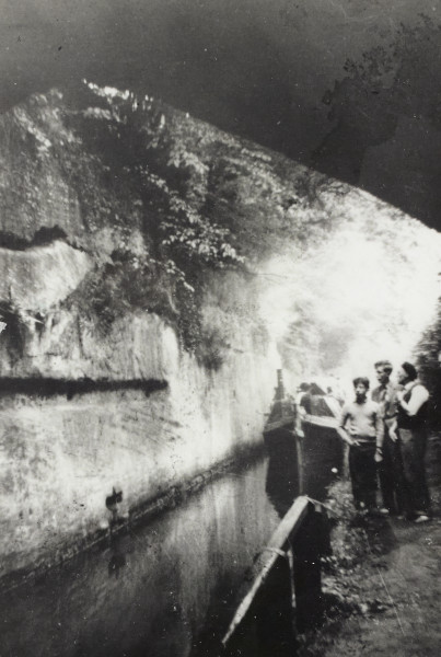
Joe Skinner’s narrowboat Friendship approaching Armitage Tunnel in August 1958 from Rugeley side. The photograph shows the confined channel, with the towpath squeezed between the canal and the sandstone cutting.
By the twentieth century the tunnel was carrying a very different traffic from that envisaged by Brindley. Commercial carrying gradually declined and pleasure boats increasingly appeared on the canal, but boats still passed through essentially the same tunnel constructed nearly two centuries earlier.
Trouble underground
Coal had been mined around Cannock Chase for generations, but twentieth-century production became increasingly concentrated in large collieries. Brereton Colliery closed in 1960 and its workforce transferred to the newly developed Lea Hall Colliery, where mining was undertaken on a far greater scale, much of its output supplying Rugeley Power Station.
The effects of mining were increasingly apparent at the surface. Subsidence became a major problem in Armitage, affecting not only the canal but buildings and the surrounding landscape. Armitage Lodge was so badly affected that it was eventually demolished completely in 1975.
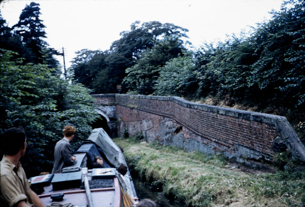
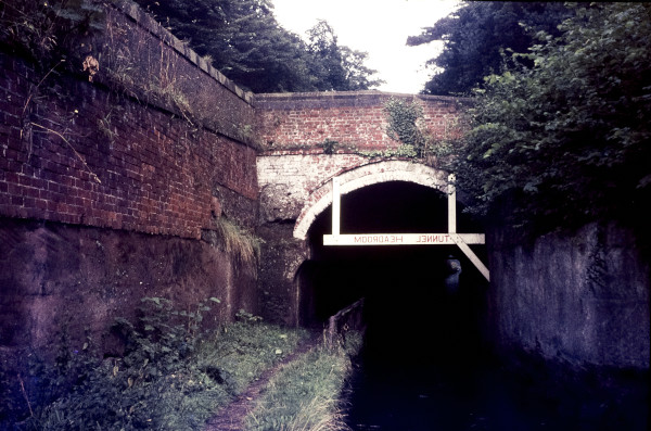
Repeated attempts were made to keep the increasingly troublesome structure open. Photographs from its later years show successive stages of reinforcement around the entrance as movement distorted the arch and cracked the sandstone above it. These measures could only postpone the problem. By the beginning of the 1970s the future of the old tunnel was in doubt.
The end of Armitage Tunnel
By January 1971 British Waterways knew that Armitage Tunnel could not survive much longer. Continued mining subsidence was expected to lower the ground above it, bringing the shallow roof down with it and reducing the headroom available for boats. The proposed solution was radical: the roof would be removed and the tunnel converted into an open cutting.
Initially the work was to be carefully arranged around the boating season. But events overtook those plans. On 16 March the Wolverhampton Express and Star reported that the canal had been closed between Armitage and Fradley while the tunnel roof was removed. British Waterways now described the tunnel as unsafe to use.
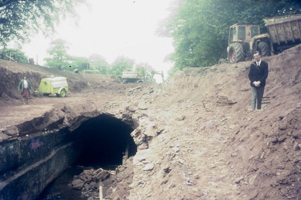
Opening out Armitage Tunnel, May 1971. Excavators remove the ground and rock above the tunnel, exposing the brick roof before its removal. The work transformed the former tunnel into the open cutting seen today.
The sudden closure caught the growing pleasure-boating industry by surprise. Holidaymakers who had booked canal boats for journeys towards Llangollen and the Peak District found their routes blocked, while one hire-boat operator complained that he had received only a few days’ notice.
Draining the canal produced one unexpected complication. On 30 March 1971 the Express and Star reported that workmen preparing to remove Armitage Tunnel had discovered a heavy 13-inch explosive shell lying in the canal bed. It was handed to Rugeley police and Army bomb-disposal experts were called in. As the newspaper observed, hundreds of pleasure boats using the Trent & Mersey must unknowingly have passed over it.
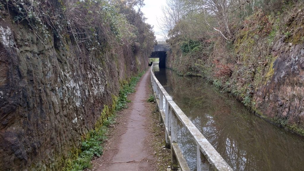
Removing the roof was not simply a matter of demolishing the tunnel. The Rugeley–Armitage road ran directly above it. The road therefore had to be diverted temporarily, the ground excavated and the old tunnel opened from above. A new bridge could then carry the road across what had become an open canal cutting.
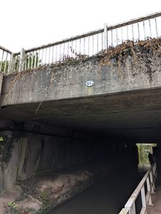
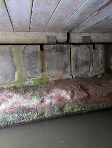
Contemporary photographs record the extraordinary operation. Excavators stripped away the ground above the canal until Brindley’s eighteenth-century tunnel was exposed. The canal was reopened to boats during the summer of 1971, although major engineering work continued around it. By the autumn the old tunnel had largely been opened out but work on the road crossing and surrounding site continued through the winter. Photographs taken in April 1972 show the completed scheme, with the former tunnel reduced to a deep sandstone cutting and the Rugeley road carried across it on a new bridge.
Subsidence Changes the Road Again
The opening out of Armitage Tunnel was not the end of the problems caused by the unstable ground in this part of the village. For many years the main road ran at a much lower level than it does today, passing close alongside the Trent and Mersey Canal.
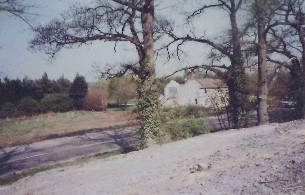
Further subsidence eventually required another major alteration. In 1983 substantial engineering works were undertaken to move the road farther away from the canal and modify its level and alignment. Contemporary photographs show the scale of the operation, with a large new embankment being constructed above the old road before the replacement carriageway was formed.
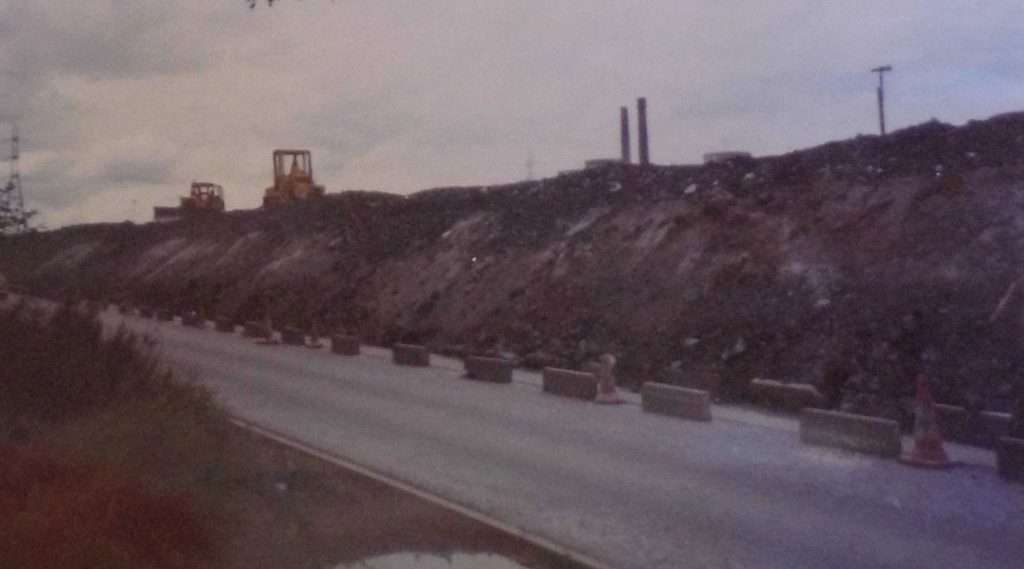
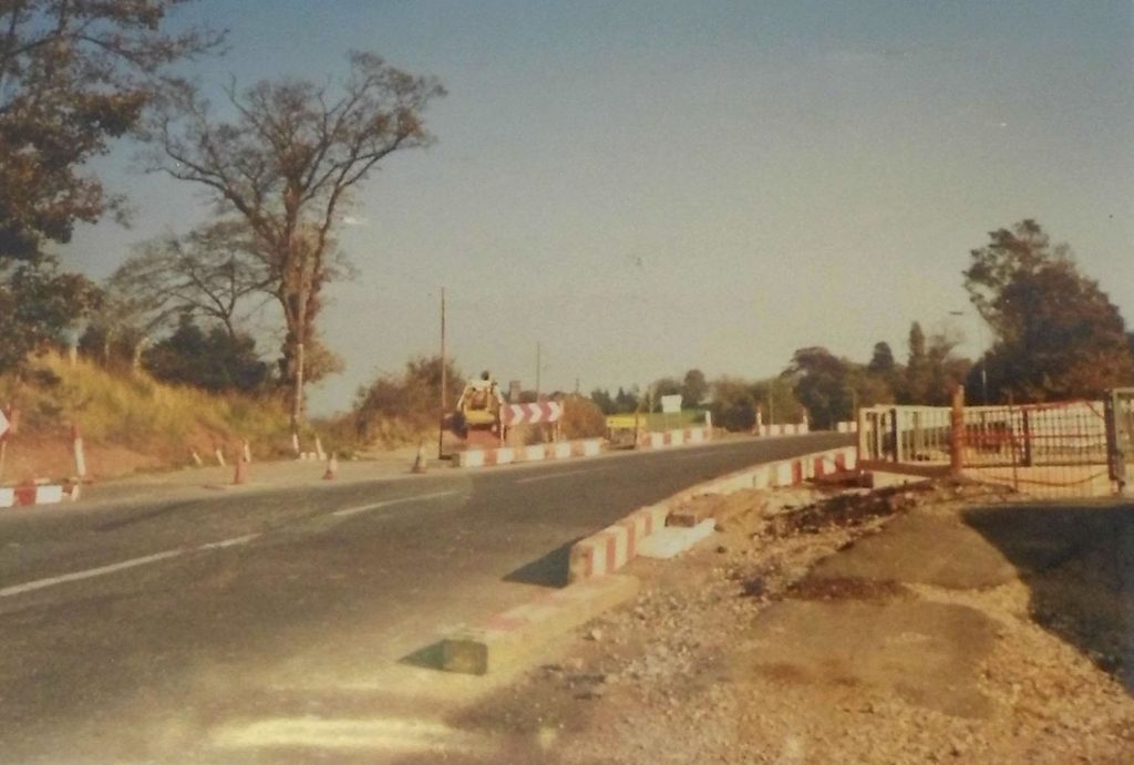
Part of the former road survives today beside the canal. Now closed to through traffic, its strip of tarmac provides a reminder of just how different this part of Armitage once looked. The present road runs higher up and farther from the canal.
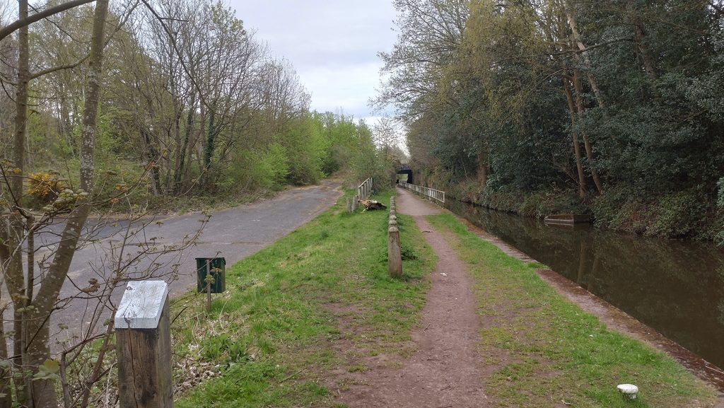
More than two centuries after Brindley drove his canal through the sandstone ridge, the difficult ground around Armitage was therefore still influencing the routes taken through the landscape.
Fascinating, as ever, Richard.
Very interesting description of the work taking the tunnel roof off,we remember it but can’t recall how the traffic was diverted. Such clever men all those years ago constructing the canals.
Excellent article Richard.
I remember walking through the tunnel, but didn’t know the history of it.
Lived through that in the early 70s and don’t remember it!
Brilliant article.
Only bit I can’t make sense of is, I was born in 1979 and somehow I just about remember travelling to Rugeley on a lower road which I know is still there today. Meaning, I just about remember the road as it’s now being built.
This must have been early 80’s, which then does not correspond to the article when it says the bridge was built early 70’s.
Was some more work carried in the area in the 80’s.
It would be great to see some photos of this area when people traveled on the lower road and when the current road was being built.
I am almost sure this also ties in when the canel height used to be at the same level as the Plum Pudding.
Just interested to know and jog my memory.
Andy – Looking through that later 1983 work I decided to add it to the article